


DEM | ETM2 Enhanced Terrain Mesh 2m for Faroe Islands - version 1.0.0
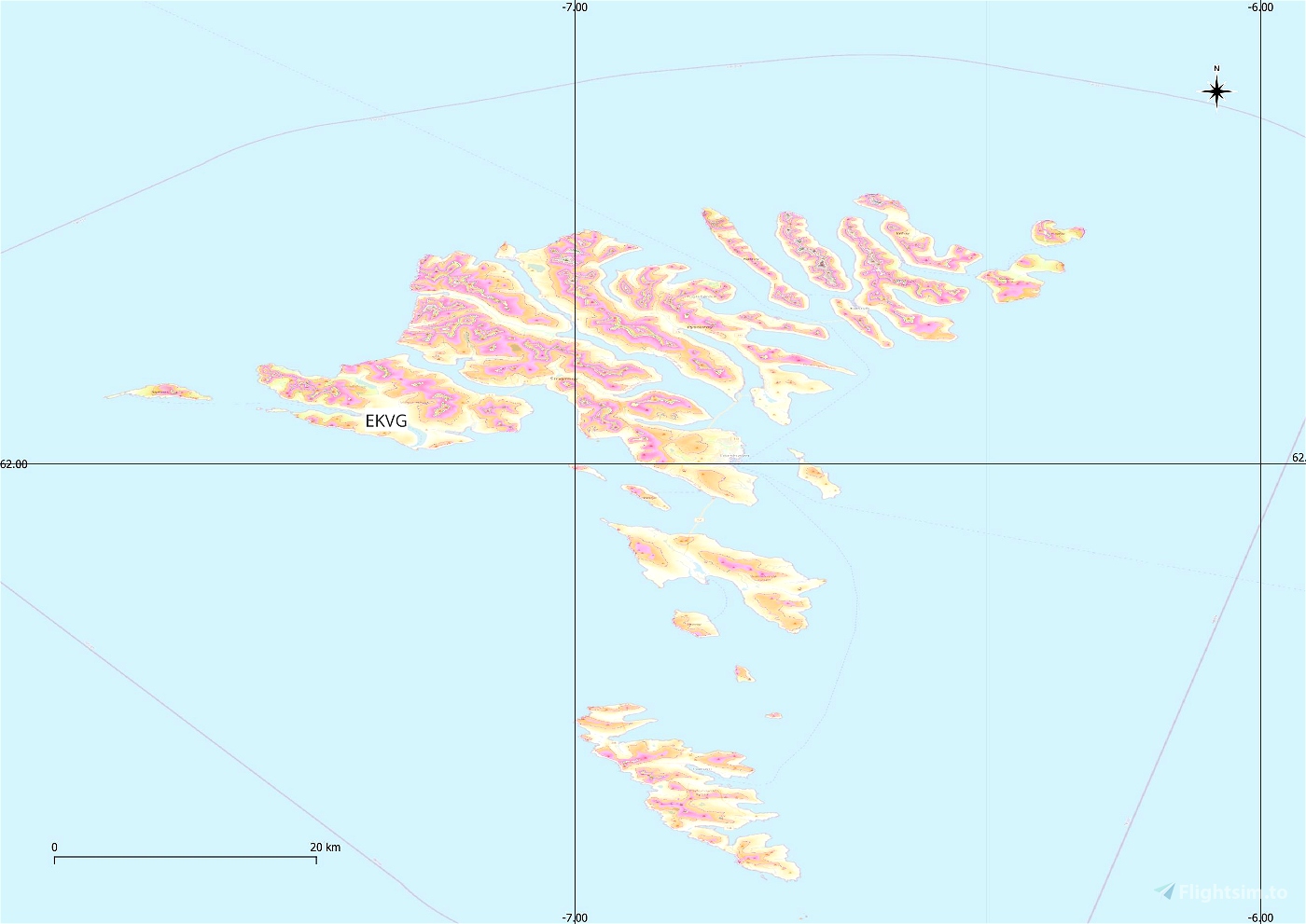
This is an Enhanced Terrain Mesh 2 meters derived from Føroyakort / Umhvørvisstovan, which is the cartographic authority of the Faroe Islands, Mainly the area covered by this terrain mesh is related to the region of ... see coverage map.
Affected Sceneries
Any large Payware and Freeware Airport I could think of, has been excluded from the mesh. So hopefully the glitches will be minimal.
Please report any bugs with sceneries or airports and I will see what I can do!
Created using MSFS Toolkit by Nool Aerosystems (MSFS Toolkit).
This release introduces flattening for all bodies of water. (Thanks to @Henrikx)
Note:
This Terrain Mesh doesn't conflict with the only freeware airport in the Faroe... if anything it's the other way around. I'm sorry, but it's not up to me.
On Discord: ItalianCharter Team // Gjanosh61#9850
Please don’t feel as though you have to, but if you wanted to buy us and the team a coffee to support the work. Thank you very much.
https://www.buymeacoffee.com/gjanosh

 Gjanosh61


21 days ago
fruehlingimwald
21 days ago
21 days ago
Gjanosh61
fruehlingimwald
25 days ago
21 days ago
Gjanosh61
Nimic
25 days ago
25 days ago
Gjanosh61
imb12
25 days ago
25 days ago
Gjanosh61
efbiaye