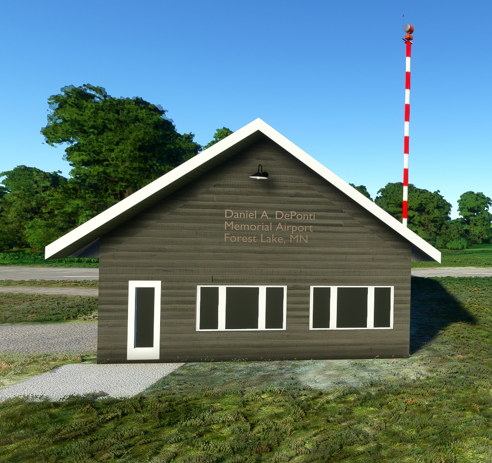
About 25D Forest Lake Airport, MN
Forest Lake Airport is located 2 Miles to the South West of Forest Lake, just off highway 61.
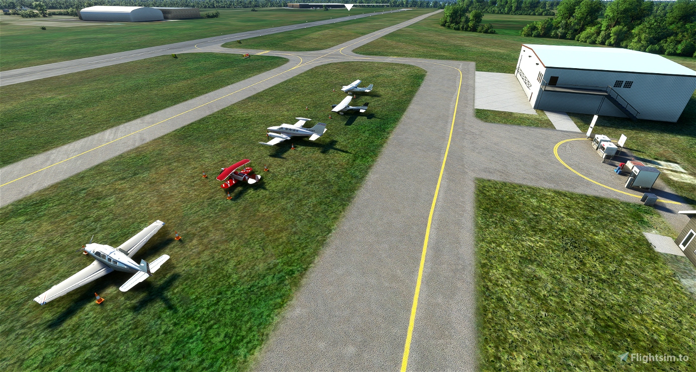
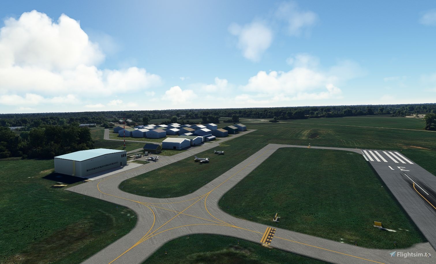
It has a single runway, 13/31 which is 2,700 feet long and 75 feet wide. It is made of Asphalt and is in good condition. It has 4 Light PAPI on each end, placed to the left of the runway. The Glide Path is 3.5 degrees.
There are Runway End Identifier Lights and medium intensity edge lights.
In calm conditions, runway 13 should be used. According to airnav.com, there are 33 Aircraft based at the field, 1 of which is a Helicopter. All the fixed wing aircraft are single engine.
The traffic pattern is left, and the elevation is stated as 929.5 ft.
Features of this Scenery
Despite not being launched until 2020, the data on which Asobo built the World was already at least 4 years out of date in some cases. So it was, that the Asphalt Runway of today is still grass in the Asobo Version.
- New (2016) Asphalt Runway and taxiway.
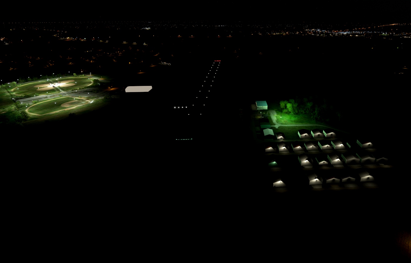
- Runway Lighting
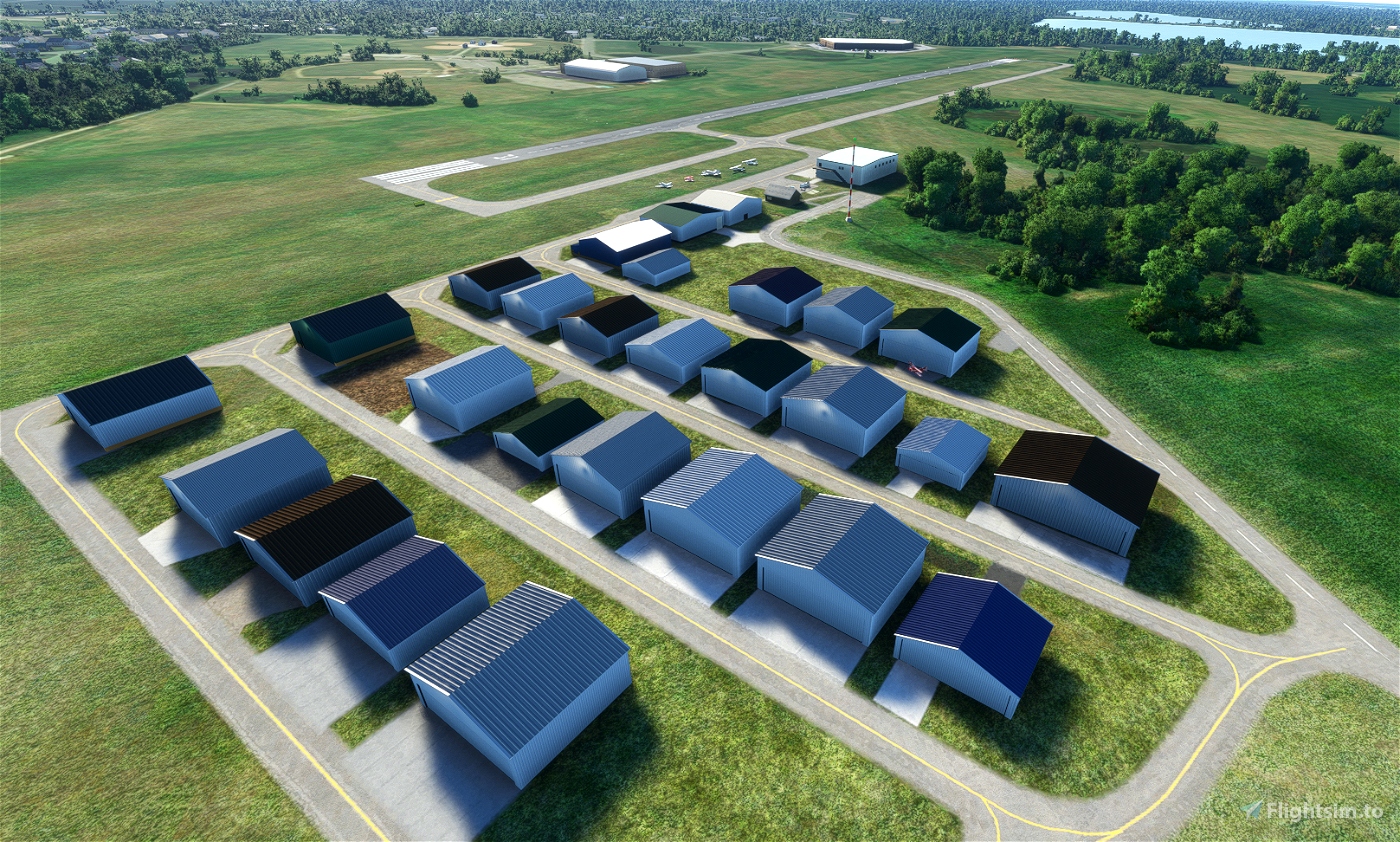
- Hangar 57, which was built in 2019.
- New Hangars that have been built between 2015 and 2021.
- Animated Airport Beacon.
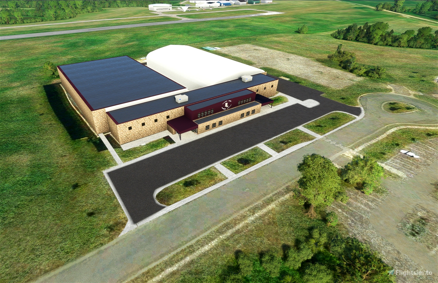
- Forest Lake Sports Center (2008)
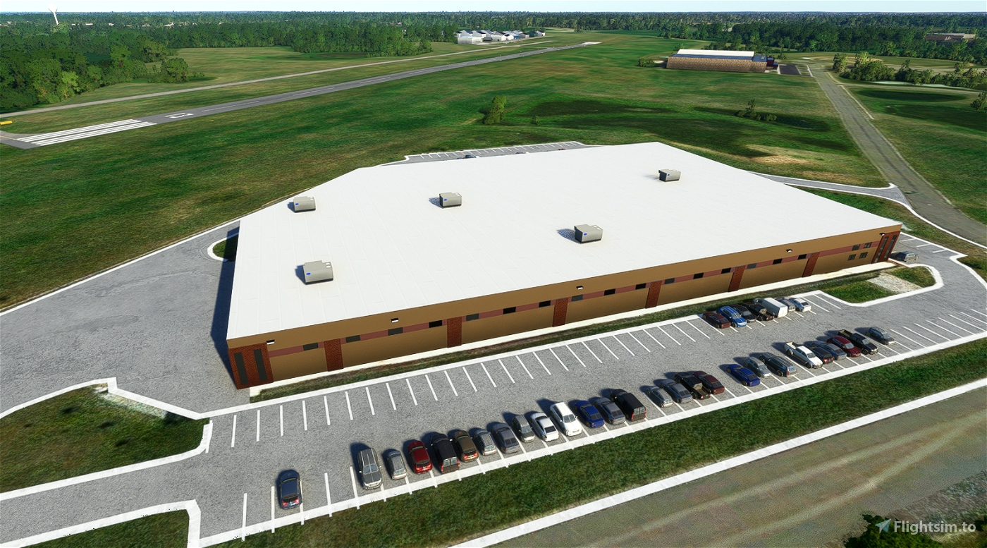
- TeamVantage Factory to the North West of the Field
- Tidied up farm buildings to match 2021.
- Lit Windsock - Orange in correct position.
- Grass Parking places and static aircraft denoted by Red/White Cones.
- Water Tower near High School added for VFR Clarity
Installation
Delete any previous version from the Community Folder. (Rarely necessary)
Unzip 25d-forest-lake into the Community Folder.
Unresolved Issues
I think there are some markers on the taxiway, but I don't know what they are. They may be cones, reflective markers etc. I have been unable to find any video from the cockpit on the taxiway. I also believe there should be another Windsock, but I don't know its position.
The rotating beacon is throwing green light when it should be white and is not visible from very far off. Hopefully this interaction between Blender and MSFS will get fixed one day.
With no Google Earth 3D images of the airport since 2014, the design of each hangar cannot be copied precisely. They will be updated as I get more information, or drive there are take photos.

 MNSceneryDesign


2 months ago
CaptainMoonlight
8 months ago
JakeFlight
Hello, with your work, ground services in other airports disappear.
Please if you can fix the problem.
Thank you
1 years ago
Sorry for the delay in responding. I will apply a fix shortly.
1 years ago
MNSceneryDesign
albarelys
Sorry that this too such a long time, but if you haven't found it yet, here's the location of the rotating beacon. N47.827645 W-91.8309801. Both Goggle, and Bing maps use the same measurement,
1 years ago
Hi, I think I generated a KELO version for you, but I can't remember how I sent it. If you didn't get it let me know and we will find a way.
1 years ago
MNSceneryDesign
johnek
love your work. I've downloaded them all. I have 2 requests. could you move up north and take a look at KHIB, Range Regional. The default one is very bad. Second could you place a windsock at KELO Bing, or google aerial maps show the location. the new taxiway to runway 12 needs to be added. Thanks again for your work.
2 years ago
Thanks for your comments, they make it worth while.
Regarding other airports, we are always discussing our next projects, and we will certainly add yours to the list. A lot depends on what 3D information is available. If Google Earth has no 3D imagery, then it is hard to handle building height, shapes etc.
Regarding the windsock, it used to be possible in FSX to create a BGL file with all the information needed, and just add it to the project. I'm not sure if that can be done in MSFS, but I will certainly take a look.
2 years ago
MNSceneryDesign
johnek