Google Maps and OpenStreetMap for Microsoft Flight Simulator 2020
A web application that allows to monitor your flight on an interactive map from any device with a web browser.
Features:
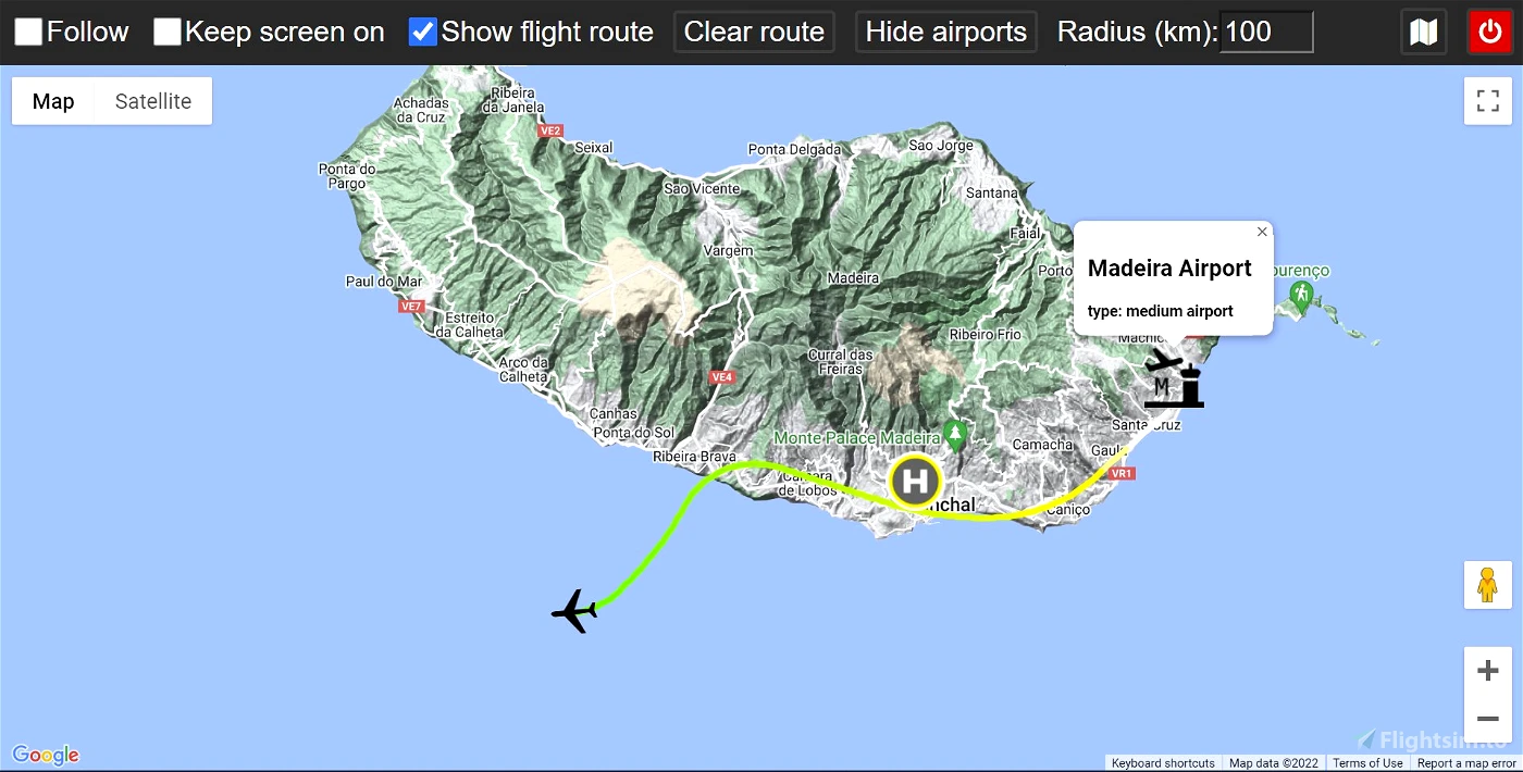
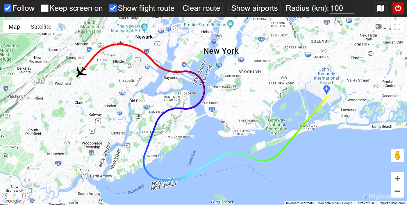
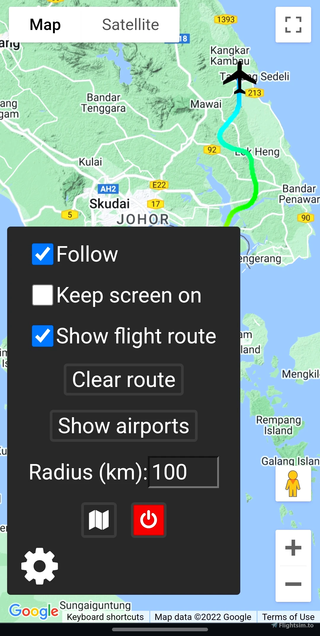
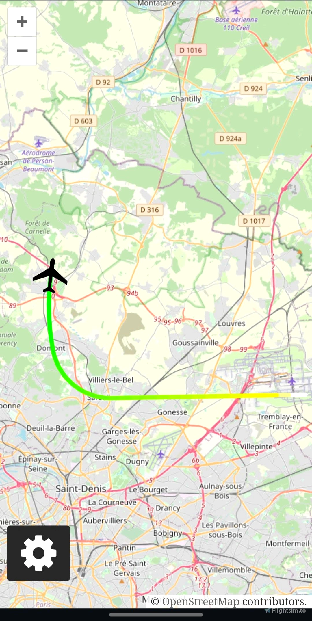
- Google Maps and OpenStreetMap support
- Displaying route with different colors indicating aircraft's altitude
- Finding and displaying airports within a specified distance from the aircraft
This is an open source project - check it out on GitHub
How to use
Installing
1. Download the latest release
2. Unzip the downloaded file
Starting
1. Navigate to the extracted folder and run the maps-server.exe file
2. When prompted, allow for the access through firewall, otherwise you won't be able to open the map from other devices
3. Follow the information displayed on screen
4. As soon as you start your flight in Flight Simulator, you should see the aircraft properly displayed on the map
Updating
1. Delete the folder containing all of this program's files
2. Follow the installation guide again
Troubleshooting
If your Google Maps view is grayed out and For development purposes only or any error message is displayed, you'll need to provide a Google Maps API key, you can get a free trial here (the key has to have access to the Maps JavaScript API). After you've obtained your key, you can simply copy and paste it into api_key.txt file located inside your extracted folder. After your free trial has expired, you can still use the Google Maps API for free, as long as you don't exceed 200$ a month (which should be more than enough for personal use) or you can always use OpenStreetMap for free without providing any additional stuff.
Updates
v2.1.0
- added display of more information about airports
- added status icon
- updated SimConnect libraries
- other improvements and bug fixes
v2.0.0
- added support for OpenStreetMap
- project has been rewritten for easier distribution and usage - no need of any installation
- improved displaying route
- other small improvements
v1.1.0
- added option to display route on the map
- added option to show airports in a selected radius
- updated UI for both desktop and mobile
v1.0.1
- app now properly closes connection with the SIM when window is closed (previously only when it was terminated with CTRL+C)
- follow is now temporarily disabled when user interacts with the map, allowing for easier looking around the map
- map now fits into the window (no scrollbar on the right)
- app will now notify users of a new release


3 months ago
3 months ago
Rybeusz100
DAROMIRCHH321
4 months ago
4 months ago
Rybeusz100
rob21blue
Got the api key, copy-pasted into api_key.txt, restarted, get a big fat "Oops - something went wrong". Javascript console says that api key needs to be loaded via a callback, not directly.
Also, no instructions to use openstreetmaps.
So, broken.
I already have nginx and php-cgi installed (start when I need to test files locally, stop when I'm done), no problems, so it's not like I am not able to run a server ... and no problems with running Little Navmap. So it's the app. Sorry 😞
Needs, at the very least, a README or HOWTO for openstreetmaps
7 months ago
6 months ago
Rybeusz100
Barbra
9 months ago
kfli
10 months ago
9 months ago
Slips
gol
Thank you very much.
1 years ago
khakans
Hi Nedivi, Is it true that the line with elevation marker colors corrosive with the elevation progression from the starting point? Whether I start at sea level or an airport at 3000 meters. It always starts with the same color...... Is it possible to change that in a color gradient calculated from AGL?
1 years ago
The colors are based on the AGL height, so it's expected that it starts with the same color (white) regardless of which airport you pick as your starting point
1 years ago
Rybeusz100
FeGo
For some reason I cannot access it through my phone. Just keeps loading and gives me a timeout. Through localhost on main machine is fine
2 years ago
Hey, please make sure that:
2 years ago
Rybeusz100
Nedivi
Hello.. I just started using the google map for msfs2020.. But it shows the only for development mode in the map,, API entered in the text file. but still it is the same
2 years ago
Hello, please make sure that the Maps JavaScript API is enabled for this key. Do you see any warnings/errors related to the key (missing, invalid etc.)? -> press F12 and go to the 'console' tab to view the logs
2 years ago
Rybeusz100
AdamsWing
It ran from the same PC on secondary display without any problems. From the iPad it showed "For development purposes only". After generating the Google Maps API key - everything is fine. Thanks for this app.
2 years ago
saulmaz
Hi, thanks for this app, it's working perfectly for me, using a second display. Perfect!
2 years ago
Pakmann
error message when I click on run, it says connection failed retrying. It doesn't ever establish the connection.
2 years ago
Same. Connection failed, retrying. The app will start as soon as the connection is established.
2 years ago
netrace
vmpassanante
Have the API key in txt file in same directory as app.py, The Google map is still greyed out with title "for development purposes only". What am I doing wrong?
2 years ago
Is the file named api_key.txt? Does it contain only the key? Is the JavaScript maps API activated for this key?
2 years ago
Rybeusz100
CaptainNetflix
What is the way, if want to uninstall the program completly; Thanx for you help
2 years ago
Delete the folder containing all the files you've extracted, there's nothing outside of it
2 years ago
Rybeusz100
Fetz
sorry dude, but the flight route isn't showing correct because of the white line to africa, maybe a little mistake, i like your app, it's awesome 😊
2 years ago
It's because the simulator gives the position of approx. (0,0) when you're in main menu. You can clear route after you've loaded into your departure airport and the route should work fine
2 years ago
Rybeusz100
wernerb